top of page


Meadow Lines uses geospatial data produced by walking to generate scripts for design intervention. In 2019 I began to transform a one-acre industrial soybean field in central Ohio into a publicly accessible meadow by mapping dozens of my walks through the site that respond to vegetative growth, micro-topographies, species emergence and other ecological conditions.
07 - 2022
narrowleaf mountain mint
pycnanthemum tenuifolium
smooth white beardtongue
penstemon digitalis
06 - 2022
translation of GPS paths of movement;
laser etching on paper
+
07- 2022


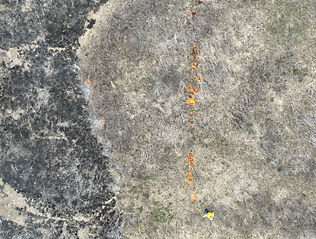
I record the route of each walk via GPS. I analyze the patterns of these walks and respond with maintenance decisions that include seeding, weeding, and the mowing of paths. I can walk across the meadow when its grasses are low and imprint the memory of that movement into the field by mowing its trail. Later, evidence of these interventions remains as bands of vigorous growth and distinct combinations of species.
These paths are a type of drawing, but possess a critical spatial and sensory dimension that distinguishes them: they become drawings to move through.


07 - 2022
grown-over paths

By recording my walks over months and years, I register my bodily response to shifts in site phenomena. In this way, walking becomes a form of design drawing and an archive of physical interactions with the landscape.
For example, this drawing layers 30 of my walks taken through the meadow, a cumulative length of 10 miles.
I also make prints and drawings using vegetation collected from the meadow. The roots of these plants are another kind of path.

07 - 2023
plant monotype
07 - 2023
plant monotype; common mallow
08 - 2023
before mowing
Anchor 2

roots of Echinacea purpurea

roots of Sorghastrum nutans

roots of Lonicera maackii

08 - 2022


08 - 2022
08 - 2022


09 - 2023


Anchor 1

09 - 2023

30 walks through the meadow taken between 2019 and 2022
+
09 - 2021

09 - 2023
10 - 2023
paths recorded while drawing in
the meadow in autumn of 2023

11 - 2021


invasive foxtail weighed down with snow
01 - 2021

01 - 2021
02 - 2024


02 - 2024

02 - 2024
the meadow covered in early morning frost in february


controlled burn at the meadow
04 - 2024

04 - 2024
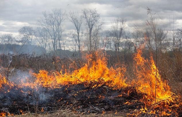

In April 2024 I acquired the necessary permits to perform a controlled burn of the one-acre meadow. Burning is important in controlling the growth of woody vegetation, managing invasive species and can also stimulate new growth of native plant species.


04 - 2024
after the burn
04 - 2024
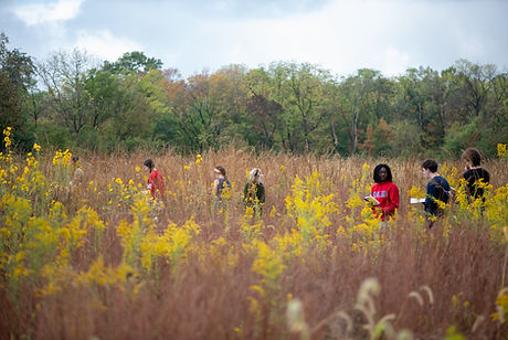
paths recorded while reseeding the meadow with students after the controlled burn

Anchor 3
05 - 2024


06 - 2025


bottom of page